Aviation has always been a field defined by precision and innovation. From the earliest days of flight, pilots have needed reliable ways to find their way in a place where there are no road signs, lanes, or stoplights. Over time, a variety of navigation methods have emerged, each offering unique benefits and helping ensure the safety and efficiency of air travel.
For students, aspiring pilots, and anyone fascinated by flight, understanding these systems offers a window into both aviation and its high-tech present.

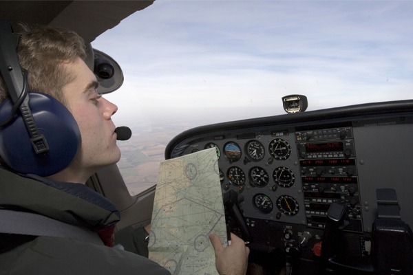
Pilotage: The Art of Visual Navigation
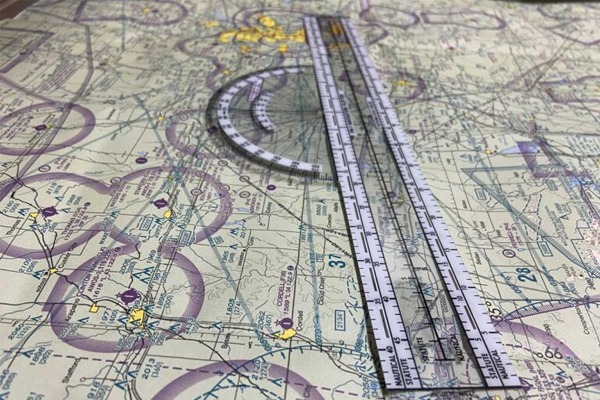
Before electronics and satellites, pilots relied on their eyes. Pilotage is the act of navigating by visually identifying landmarks on the ground and comparing them to a map or sectional chart. Rivers, lakes, highways, railroads, towers, and city boundaries become essential reference points to track a plane’s progress and determine its position.
Pilotage is still widely used today, especially during Visual Flight Rules (VFR) operations. It’s especially valuable in good weather conditions with clear visibility, low-altitude flying (such as training flights or scenic tours), and in areas with distinctive terrain or landmarks.
In the end, pilotage teaches situational awareness and the importance of looking outside the cockpit. Even in a world dominated by GPS, the ability to match what you see outside with what’s on the map is a critical foundational skill for any pilot.
Dead Reckoning: The Math of Estimation
Dead reckoning is another traditional navigation method, one that involves calculating your current position based on your last known position, heading, speed, and time flown. It doesn’t rely on outside reference – it’s all about using known information and estimating.
Let’s say you take off from an airport and set a course of 090° (East) at 90 knots. If you fly at that heading for 30 minutes, you should be roughly 45 nautical miles east of your departure point – assuming there’s no wind. Pilots must factor in wind correction angles to adjust for drift and refine their course.
Dead reckoning teaches pilots about planning and aircraft performance, and it reinforces the value of staying alert to possible deviation due to wind or weather. It’s also useful as a backup when more advanced systems fail or become unavailable.
In fact, during some cross-country flight training exercises, student pilots are specifically required to navigate without using GPS to develop their skills in both dead reckoning and pilotage.

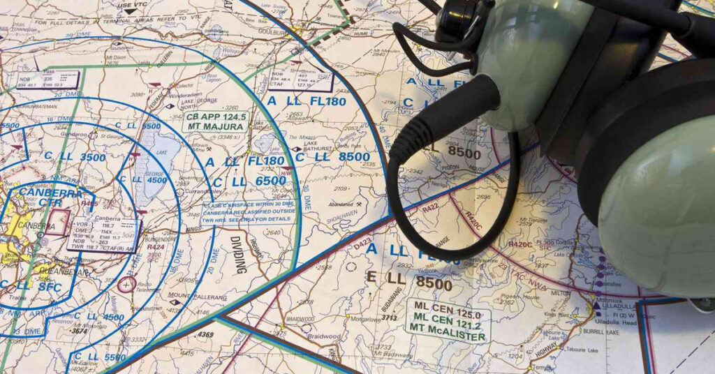
VOR: The Backbone of Radio Navigation
In the mid-20th century, a major technological leap occurred with the introduction of Very High Frequency Omnidirectional Range – or VOR. These are ground-base radio beacons that transmit directional signals pilots can use to determine their bearing to or from the station.
A VOR station sends out signals in every direction (360 radial degrees). Using onboard instruments like the VOR receiver and Course Deviation Indicator (CDI), pilots can tune into a specific VOR frequency and select a radial (or direction) to follow. This allows them to fly to or from the VOR with a high degree or precision.
Some VORs are also part of a larger network, allowing pilots to “connect the dots” between stations to form airways that resemble highways in the sky.
Even in the age of satellites, VOR remains an important backup navigation tool. The FAA has begun reducing the number of VOR stations as GPS becomes more dominant, but a minimum operational network remains to support safety and redundancy in case of satellite disruptions.
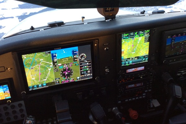
GPS: The Gold Standard of Modern Navigation
The Global Positioning System (GPS) has transformed aviation, just as it has everyday life. Using a constellation of satellites orbiting Earth, GPS allows pilots to determine their position with extraordinary precision, often within just a few meters.
Modern GPS receivers – whether standalone unites or part of a glass cockpit system – can provide:
- Real-time aircraft position on a moving map
- Direct routing to any airport, waypoint, or coordinate
- Vertical navigation and terrain alerts
- Integration with autopilots and flight management systems
With the rise of GPS-based procedures, the FAA has developed thousands of RNAV (Area Navigation) routes and GPS approaches that allow for increased flexibility, safety, and fuel efficiency.
Yet, despite all these benefits, pilots are trained never to over-rely on GPS. Redundancy matters – hence the continued use of VORs and emphasis on traditional navigation methods.
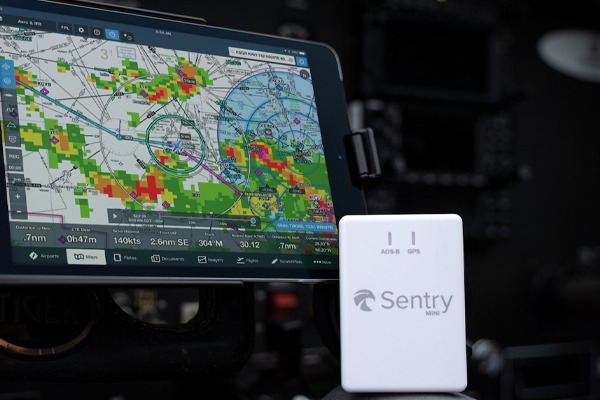
ADS-B: Seeing & Being Seen
One of the most important developments in recent years is ADS-B, which stands for Automatic Dependent Surveillance-Broadcast. This is not a navigation method per se, but a tool that greatly enhances a pilot’s awareness of other aircraft and their own visibility to air traffic controllers.
An aircraft equipped with ADS-B Out broadcasts its GPS-derived position, speed, altitude, and other data every second.
ADS-B In allows pilots to see other nearby aircraft on their screens – often on the same GPS moving map used for navigation. Some systems also include weather and traffic services for added safety.
ADS-B represents a cornerstone of the FAA’s NextGen Airspace Modernization Program, aiming to make flying safer and more efficient through satellite-based technologies.
Why Navigation Skills Still Matter
With such advanced systems at their disposal, why should student pilots and aviation enthusiasts still study older navigation methods?
Because in aviation, redundancy and understanding are key. GPS signals can fail. Electrical systems can malfunction. Knowing how to use VOR, dead reckoning, and even pilotage ensures that pilots remain competent and confident under any condition.
Moreover, each navigation method teaches different aspects of aviation:
- Pilotage hones visual awareness.
- Dead reckoning builds planning and estimation skills.
- VOR introduces radio systems and instrument interpretation.
- GPS connects students with modern avionics.
- ADS-B adds an extra layer of safety and coordination in today’s crowded skies.
Whether soaring over Kentucky hometowns or navigating across the country, the tools pilots use to find their way have some a long way since the early days of aviation. At DreamFlight Charities, we believe that understanding these navigation systems isn’t just about becoming a better pilot – it’s about developing curiosity, confidence, and capability.
Whether you’re a middle school student at one of our aviation camps or a high schooler in our OpenSkies Flight Club, we encourage you to keep asking questions about how aircraft work, how they travel, and how we ensure they get from one place to another – safely, efficiently, and inspired by the spirit of discovery.